Manufacturer:

Ordnance Survey Explorer 1:25 000

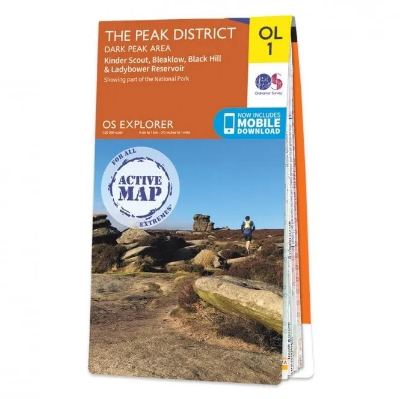
The Ordnance Survey Explorer 1:25 000 provide mapping across the whole of the UK. With a 4cm to 1km gridded scale, this is the best map for anyone operating in the outdoors, whatever your pursuit. The Explorer will get you where you want to be by road and then take you off-road on foot, by bike or horseback. The maps also show the symbols for features for things such as national trails, picnic areas, viewpoints, pubs and rights of way.

The Ordnance Survey Explorer 1:25 000 Maps are the UK's most detailed leisure maps, making them the preferred choice for walkers, hikers, runners, cyclists and outdoor enthusiasts. Produced at a 1:25,000 scale (4cm to 1km), they provide exceptional detail to help you navigate confidently, whether you're exploring countryside footpaths, mountain trails, forests or local rights of way. Each map includes a free digital download, allowing you to access the same mapping on your compatible smartphone or tablet when you're out and about.

Explorer maps clearly show public rights of way, National Trails, bridleways, cycle routes and contour lines, along with useful features such as campsites, car parks, pubs, picnic areas, viewpoints and places of interest. Whether you're planning a local walk, a multi-day hike or discovering somewhere new, an Ordnance Survey Explorer Map remains one of the most trusted navigation tools for exploring Great Britain.

Features:
Detailed 1:25,000 scale Ordnance Survey mapping
Ideal for walking, hiking, cycling, trail running and outdoor navigation
Shows public rights of way, footpaths, bridleways and byways
Includes National Trails and recognised recreational routes
Detailed contour mapping for accurate terrain interpretation
Displays campsites, car parks, picnic areas, pubs and viewpoints
Includes selected tourist attractions and places of interest
Road network and railway lines clearly shown
Free digital download included with every map
Trusted mapping covering the whole of Great Britain

Specifications:
Publisher: Ordnance Survey
Series: Explorer
Scale: 1:25,000 (4cm = 1km)
Coverage: Great Britain
Format: Paper Map with Free Digital Download
Best For: Walking, Hiking, Cycling, Trail Running & Outdoor Navigation

Popular titles for us include:
Explorer 151 - Cardiff and Bridgend
Explorer 152 - Newport and Pontypool
Explorer 164 - Gower
Explorer 165 - Swansea, Neath and Port Talbot
Explorer 166 - Rhondda and Merthyr Tydfil
Explorer 186 - Llandeilo and Brechfa Forest
Explorer 187 - Llandovery, Llanwrtyd Wells and Llyn Brianne
Explorer 189 - Hereford and Ross on Wye
Explorer 190 - Malvern Hills and Brendon Hill
Explorer 198 - Cardigan and Newquay
Explorer 199 - Lampeter
Explorer 201 - Knighton and Presteigne
Explorer 214 - Llanidloes and Newtown
Explorer 240 - Oswestry
Explorer 253 - Lleyn Peninsula West
Explorer 254 - Lleyn Peninsula East
Explorer 392 - Ben Nevis, Mamores and Grey Corries
Explorer 398 - Loch Morar and Mallaig
Explorer 400 - Loch Lochy and Glen Roy
Explorer 495 - Isle of Man

*
*
*
*
*

The Ordnance Survey Explorer 1:25 000 Maps are the UK's most detailed leisure maps, making them the preferred choice for walkers, hikers, runners, cyclists and outdoor enthusiasts. Produced at a 1:25,000 scale (4cm to 1km), they provide exceptional detail to help you navigate confidently, whether you're exploring countryside footpaths, mountain trails, forests or local rights of way. Each map includes a free digital download, allowing you to access the same mapping on your compatible smartphone or tablet when you're out and about.

Explorer maps clearly show public rights of way, National Trails, bridleways, cycle routes and contour lines, along with useful features such as campsites, car parks, pubs, picnic areas, viewpoints and places of interest. Whether you're planning a local walk, a multi-day hike or discovering somewhere new, an Ordnance Survey Explorer Map remains one of the most trusted navigation tools for exploring Great Britain.

Features:
Detailed 1:25,000 scale Ordnance Survey mapping
Ideal for walking, hiking, cycling, trail running and outdoor navigation
Shows public rights of way, footpaths, bridleways and byways
Includes National Trails and recognised recreational routes
Detailed contour mapping for accurate terrain interpretation
Displays campsites, car parks, picnic areas, pubs and viewpoints
Includes selected tourist attractions and places of interest
Road network and railway lines clearly shown
Free digital download included with every map
Trusted mapping covering the whole of Great Britain

Specifications:
Publisher: Ordnance Survey
Series: Explorer
Scale: 1:25,000 (4cm = 1km)
Coverage: Great Britain
Format: Paper Map with Free Digital Download
Best For: Walking, Hiking, Cycling, Trail Running & Outdoor Navigation

Popular titles for us include:
Explorer 151 - Cardiff and Bridgend
Explorer 152 - Newport and Pontypool
Explorer 164 - Gower
Explorer 165 - Swansea, Neath and Port Talbot
Explorer 166 - Rhondda and Merthyr Tydfil
Explorer 186 - Llandeilo and Brechfa Forest
Explorer 187 - Llandovery, Llanwrtyd Wells and Llyn Brianne
Explorer 189 - Hereford and Ross on Wye
Explorer 190 - Malvern Hills and Brendon Hill
Explorer 198 - Cardigan and Newquay
Explorer 199 - Lampeter
Explorer 201 - Knighton and Presteigne
Explorer 214 - Llanidloes and Newtown
Explorer 240 - Oswestry
Explorer 253 - Lleyn Peninsula West
Explorer 254 - Lleyn Peninsula East
Explorer 392 - Ben Nevis, Mamores and Grey Corries
Explorer 398 - Loch Morar and Mallaig
Explorer 400 - Loch Lochy and Glen Roy
Explorer 495 - Isle of Man

Product reviews
*
*

Discount Codes

If you are a member of an outdoor or watersports group and have a discount code, please enter it in the box below.

Click here for more information on discount codes